
Activity 2
A trip around the world. Part two
In this second part, you will look for more information about your monument, organize it and record a short description.
- Where can you find this monument?
- When was it built?
- Who built it?
- What is /was it used for?
- What are its most important characteristics?
You can find this information in http://es.wikipedia.org .
Make your text clear. Use only words you know and ask for help to formulate your ideas. Use the following structure:
- Introduction (one paragraph).
- Development (one or two paragraphs).
- Conclusion (one paragraph).
When you finish writing, read the text aloud with the members of your group. Make sure that the text is well structured and can be easily understood.
To record a video select the following icon from the top tool bar in Google Earth:
The recording buttons will immediately appear in the navigation window:
The left button starts the video recording and the right button starts the sound recording.
Some advice about recording: speak loud and clear. If you want to change the camera angle as you speak, do it slowly. If not, you will distract your audience.
Avoid sharp movements and excessive use of the zoom. If you can’t control the camara well, a static image is better. The idea is to present the monument not to demonstrate your navagation skills..
Remember, the written text is more important than the Google Earth images, so don’t try to make an action film.
Help
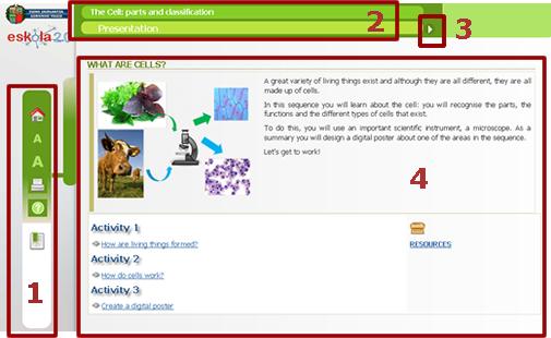
- Menu on left(in order from top to bottom): first page of the sequence (home) icon, letter size icon, print icon, help icon and index icon.
- Name of material and title of the section bar.
- Arrows for navigation (next or last page).
- Space for content.
Autor:
Lorem ipsum dolor sit amet, consectetur adipisicing elit, sed do eiusmod tempor incididunt ut labore et dolore magna aliqua. Ut enim ad minim veniam, quis nostrud exercitation ullamco laboris nisi ut aliquip ex ea commodo consequat. Duis aute irure dolor in reprehenderit in voluptate velit esse cillum dolore eu fugiat nulla pariatur. Excepteur sint occaecat cupidatat non proident, sunt in culpa qui officia deserunt mollit anim id est laborum.
Copyright:
Lorem ipsum dolor sit amet, consectetur adipisicing elit, sed do eiusmod tempor incididunt ut labore et dolore magna aliqua. Ut enim ad minim veniam, quis nostrud exercitation ullamco laboris nisi ut aliquip ex ea commodo consequat. Duis aute irure dolor in reprehenderit in voluptate velit esse cillum dolore eu fugiat nulla pariatur. Excepteur sint occaecat cupidatat non proident, sunt in culpa qui officia deserunt mollit anim id est laborum.
Index
- Terrestrial Coordinates: exploring Planet Earth
